Backpacking
|
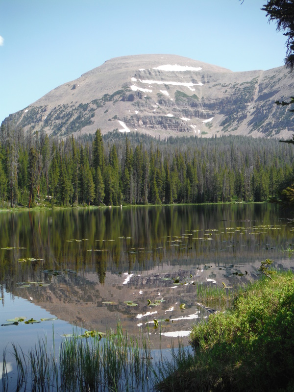
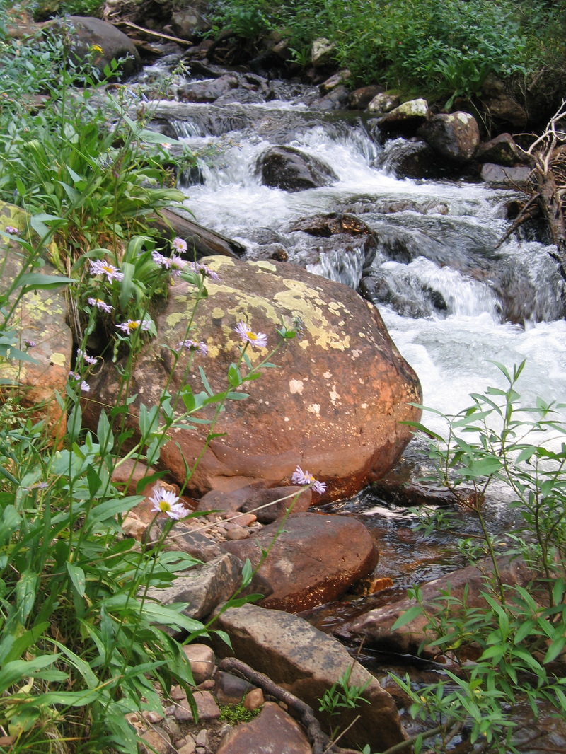
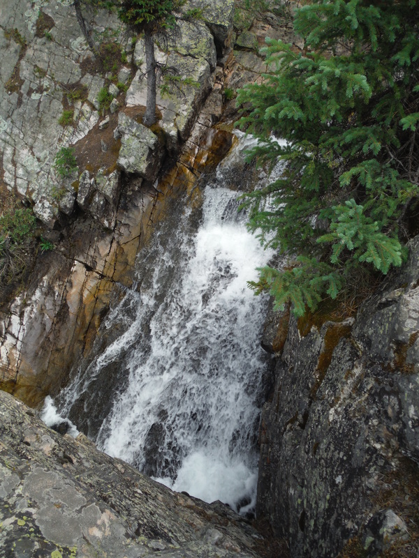
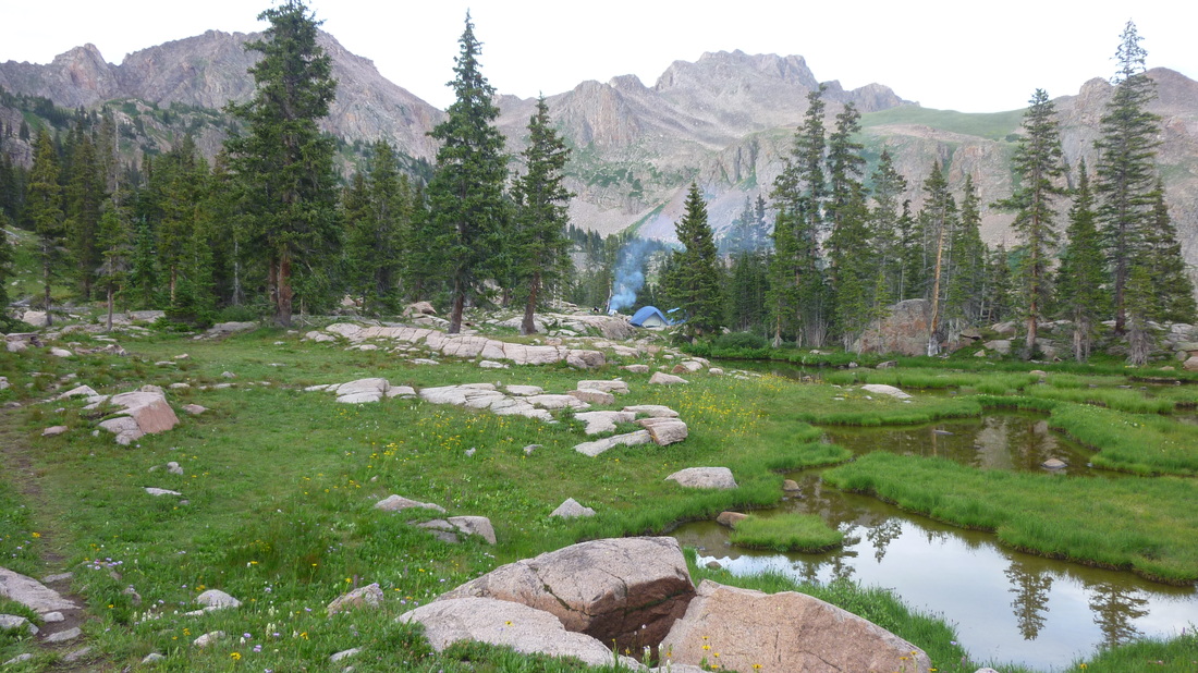
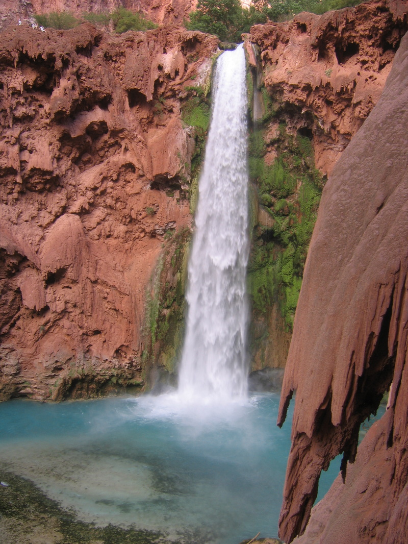
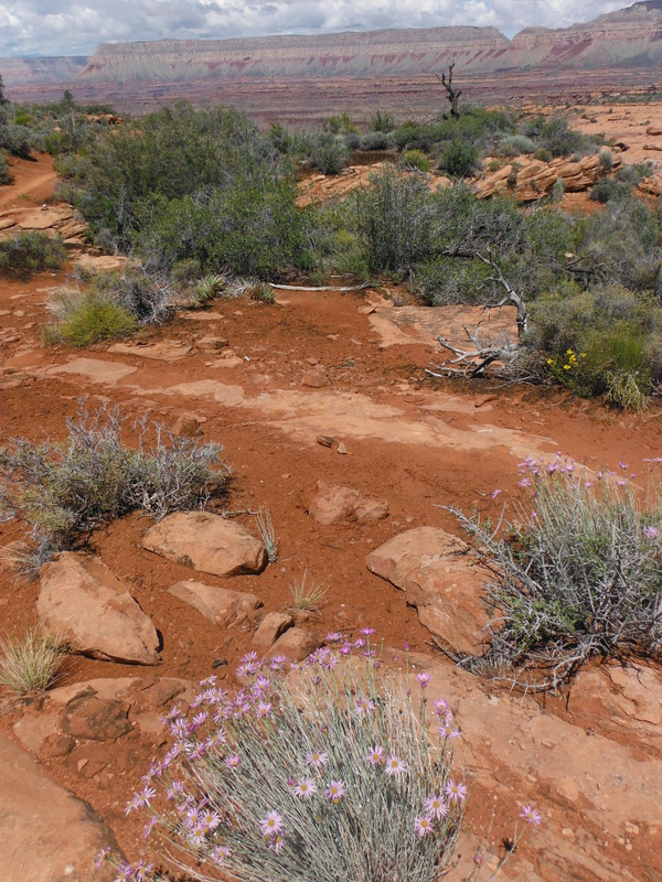
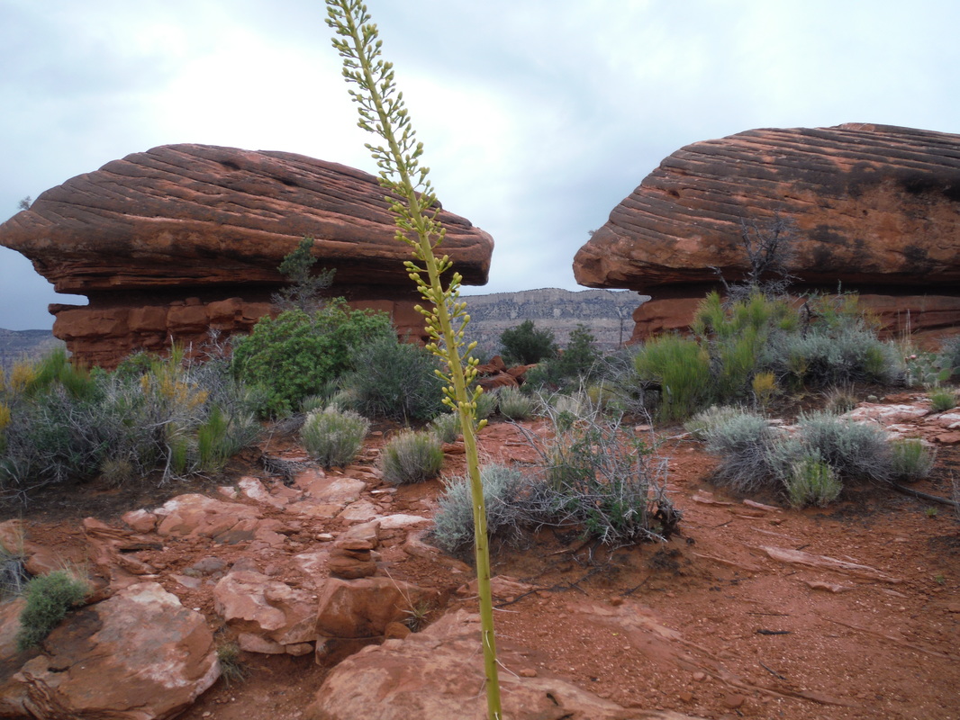
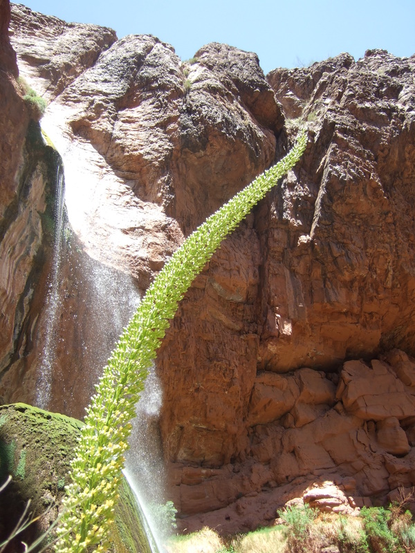
High Unitas Wilderness Area (Utah) The Uinta Mountains are the longest mountain range in the U.S. that runs from east to west and with more than 500 miles of trails, 1,000 lakes, and 26 peaks over 13,000 feet, the area is a backpacking and fishing delight. The western side of the wilderness is easily accessible from Salt Lake City, and within 2 hours, you can be at the Highline Trailhead, which runs across the entire wilderness (78 miles). There are, of course, many other trails to backpack, especially if you prefer more solitude. Some favorite spots include: East Red Castle Lake: (11 miles; 1,750 ft. elevation gain) There are a total of four Red Castle lakes in this highly picturesque area, but East Red Castle has the best fishing. The trail to the Red Castle area is relatively smooth with a gentle grade, but you will need to share it as the area does receive many visitors. Amethyst Lake: (6.5 miles; 2,000 ft. elevation gain) The trail to Amethyst Lake has some of the best scenery in the High Uintas with cascading water and soaring peaks. Make your camp at B-24, a nameless lake a mile below Amethyst Lake, as it is below timberline and there are no campfire restrictions. Fishing for pan-sized brook trout is excellent at Amethyst, but fishing is poor at B-24. If you want bigger fish, try off-trail Ostler Lake, which seems to have a good number of leader-busting cutthroats. Ryder Lake (8 miles; 2,000 ft. elevation gain): The last section of the trail is steep, but the campsites are plentiful and the scenery is striking. Fishing for pan-sized cutthroat trout is very good, and there are many small, unnamed lakes in the Middle Basin area to explore. Packard Lake (4 miles; 500 ft. elevation gain): If you are short on time, Packard Lake is a good choice. The mileage is minimal; there is little elevation gain, and there are no campfire restrictions. Just before arriving at Packard Lake walk down the out flowing stream until it cascades over a cliff and enjoy a grand view of the valley below. Four Lakes Basin (9 miles; 250 ft. elevation gain): The trail to the Four lakes Basin is more difficult than it would seem as the trail at times is a bit like a roller coaster going up then down and then up again. On arrival, the toughest choice may be trying to figure out which of the four lakes (Dale, Dean, Daynes, or Jean) to camp at and fish. But with such beautiful alpine scenery, why not try them all? Fishing can be good at any of the lakes, and Daynes even has a few Arctic Grayling in addition to trout. Granddaddy Lake (3 miles; 500 ft. elevation gain): Granddaddy Lake is another good option if you don’t want to pack too far into the first lake. City drivers, beware that the cliff-side dirt road to Grandview Trailhead is at times so narrow that two cars cannot pass each other without one backing up. Granddaddy is the largest lake in the High Uinta Wilderness. It has good camping, but the fishing is not so good due to the heavy pressure it receives. If you strike out at Granddaddy, try some of the other lakes in the Granddaddy Basin including Betsey, Pine Island, or Rainbow Lakes. Kidney Lake (9 miles; 2,000 ft. elevation gain): Kidney Lake is one of the largest lakes in the High Uintas, and it is your best bet for a good lakeside campsite in the Brown Duck Basin. Fishing pressure is heavy in this area, so don’t count too much on having fish for dinner. Clements Lake (11 miles; 2,250 ft. elevation gain): Oh the stories you’ll tell after fishing at Clements Lake. Fishing for good-sized cutthroats is productive anytime of the day it seems. Perhaps it is the long rocky trail that ensures fewer fishing competitors. Spider Lake (11 miles; 600 ft. elevation gain): Although the overall elevation gain into Spider Lake is not great, the up-and-down seesaw nature of the trail makes it much more difficult than it would appear. Camping sites at Spider are plentiful, but the fishing is not great. Try nearby Bluebell Lake for a better chance at landing the big one. Allsop Lake (9.5 miles; 1400 ft. elevation gain): One of the more beautiful hikes in the High Uintas, the Allsop Lake Trail is also easy on the back with a very gradual climb. Upon your arrival at the lake, you are rewarded not only with spectacular scenery, but also with excellent campsites and ample firewood. Patient fisherman should be able to land a few small, but very tasty, Cutthroat trout for dinner. No permits are necessary in the High Uintas, but there are campfire restrictions at many of the lakes (except where noted above). Other Wilderness Areas Popo Agie Wilderness (Wyoming): The smallest of the three wilderness areas in the Wind Rivers range, this area is packed with great hiking, good fishing, and gorgeous views. For a shorter trip with good fishing, the Silas Lakes are a good choice. The trail to Upper Silas Lake is just over 3 miles, or you can continue on for another 1.5 miles to Island Lake (total elevation gain from the trailhead is just over 1,000 ft.). The fishing at Upper Silas for pan-sized trout is quite good, with the fish seemingly hitting almost anything you cast. If you’re after bigger fish, you will want to hike further up the canyon to Island Lake where the fishing is slower, but some large cutthroat trout roam the depths. Bridger Wilderness (Wyoming): As the largest and most popular of the three wilderness areas that make up the Wind Rivers range, there are plenty of choices here for a great backpacking and fishing trip. For those seeking solitude, try the Glimpse Lake Trail which provides less difficult access to great fishing, wildlife viewing, and grand scenery. Fishing at Glimpse Lake (6 miles; 1,200 ft. elevation gain) is tough, but in its depths are some monster brook trout. Nearby Prospector and Little Trapper Lakes don’t look like much more than just ponds, but the trout fishing can be good most any time of day. Eagle’s Nest Wilderness (Colorado): The Eagle’s Nest Wilderness is a gem that may get lost in a state full of superb wilderness areas; but with unparalleled alpine views and easy access from Denver, this is a no brainer for a quick trip. Try the trail to Gore Lake, which is only 6 miles, but pack light because it does have 3,400 ft. of elevation gain. During the first 4 miles, the trail gains 2,000 feet, which is difficult, but is just a warm up for the next mile where, after the trail junction, the trail shoots up 1,000 ft. The last stretch of the trail is a delight, however, with beautiful alpine views all the way to the shores of the lake. Gore Lake sits at 11,400 ft., which could be a concern for those prone to altitude sickness, but if you can make it here without getting queasy, you will witness a view of the surrounding Gore Range that is second to none. Take plenty of time to enjoy the view, as the fishing at Gore Lake won’t get anyone excited. If you can catch enough for dinner, you are living a charmed life indeed. Havasupai (Arizona): This trip is on Native American land belonging to the Havasupai Tribe, and all services are provided by or under the direction of the members of the tribe. While not at high elevation, nor terribly long (just 10 miles each way), because of the high temperatures in the canyon, you’ll want to get an early start. Havasupai can get very crowded on summer weekends, but the sculpted red rocks, powerful waterfalls, and blue-green travertine pools are worth it even at its busiest. Plan ahead, however, as you do need to reserve a site in advance. For those who don’t wish to walk, there are mules and even a helicopter. In the village, there is a small store to buy provisions and a hotel for those who don’t want to camp. Grand Canyon National Park (Arizona): There is a plethora of great hikes in the Grand Canyon, but it’s hard to beat the beauty you’ll encounter on a trip to Thunder River from the north rim of the canyon. Be warned, however, that this trip is for experienced backpackers. While the hike in is downhill, it is rough trail, and there aren’t any reliable water sources until you reach Thunder Spring, almost 10 miles from the trailhead. The trail has three steep sections followed by miles of relatively easy traveling in either direction, the most interesting being the section through the esplanade with its otherworldly rock formations. Upon reaching the final steep section, you’ll hear the roar of Thunder River and catch your first glimpse of the underground spring shooting out the side of the canyon and the ribbon of green it nurtures all the way to the Colorado River. Camping alongside Thunder River is an experience you won’t forget, but it’s not allowed until further down the trail where Thunder River meets up with Tapeats Creek (plan ahead as spots are limited and by permit only). If you have the time, the trail continues for another 2.5 miles until it meets the mighty Colorado. Remember to bring your fishing gear to try your luck at the trout that can be caught in the pools and eddies created by the churning froth along the way to the Colorado. A splendid lollipop route is a great—but even more difficult—trip option, by linking up with the trail to Deer Creek. John Muir Wilderness (California): A popular wilderness area, the John Muir Wilderness is sprinkled with trout filled lakes and scenic vistas. Many of the trails in this large wilderness are on the western slope of the Sierra Nevada Mountains, but for some solitude, try the Pine Creek Trail on the eastern slope near Bishop and backpack to Honeymoon Lake. The trail to Honeymoon Lake is only 6 miles, but it does climb nearly 3,000 feet. Throw in a fishing line at any of the three lakes along the trail (Pine, Upper Pine, and Honeymoon), and with some luck, you’ll have trout for dinner. Bob Marshall Wilderness (Montana): This beautiful wilderness area of over one million acres, provides excellent opportunities for backpacking and fishing. If you have a bit of luck and time your trip right, you could be grilling native Bull Trout and eating fresh huckleberries at camp. Try the trail to Big Salmon Lake (18 miles), which is surely big (4 miles long), but there aren’t any salmon (just trout). |
|
